Wednesday, August 26, 2009

Colorado Challenge 2009 - Rico, Colorado

Monarch Pass on my way to Rico to ride dirt bikes for a week.
Cliffs along the Blue Mesa reservoir.

A long look at Mt. Sneffles (one of Colorado's 54 14'ers that I climbed. View from Dallas Divide.


View from Lizard Head Pass.


Lizard Head Pass.


First riding day with Bill Bunt on Calico Trail.


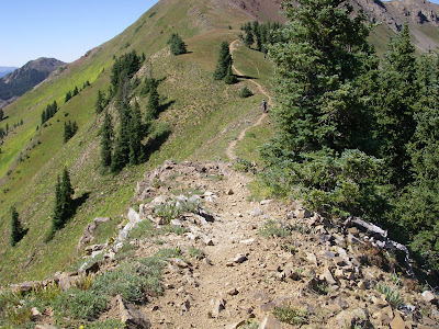
Lot's of the trails around Rico are "spooky/ scary". Lot's of chances to "mess up" and fall down the mountain. This is part of the Calico Trail. It's very narrow and runs across this very steep side-hill.


Bill making it up from a big climb.


Bill Bunt.
The trail from two Pics back runs across the face of the mountain in the background.


View from Stoner Mesa Trail.


Creek crossing on East Fork Trail. Tougher than it looks.


Great viewpoint on Bolam Pass. Lizard Head Peak on the right.


We rode this on a "Dual Sport" riding day.


We had fun riding about 15 miles on the Continental Divide.


Mel, Ed, Harry, and Don take a break at the Graysill Mine (vanadium and uranium).


Tough spot on Calico Trail.


Calico Trail


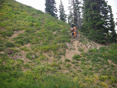
Rocky downhill.


Drop-off on both sides.


Ed, Tom, and Bryan on Calico Trl.


Bryan on Stoner Mesa.


We met up with a couple of dirtbikers at the Stoner Mesa intersection.


Above treeline (12,000 feet) fun.


More fun.


Rico's "Hippie Hot Tub" - Nice!
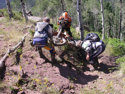


Ed has trouble with a tough "step-up.


A better look at the "step-up".


Toughest day of the week. Most of us had trouble on this hill.


Bryan was last up and got a good chuckle out of his excellent ride up.


Aaron takes a break.


The Horse Creek Trail was blocked by a downed tree and we had to walk the bikes down the scary hill to the trail below.
Note! Aaron rode down this but don't try it at home.


Mining display in Rico.


Galloping Goose train on display in Delores. About nine of these were built and ran between Ridgeway, Cortez, and Durango.


I had a lot of fun attending a Pow Wow in Cortez.


Running the Pikes Peak Ascent - August 2009

Pikes Peak in background! My brother Doyle and my daughter Traci were registered to run the Pikes Peak Ascent (13.3 miles and 7,800 feet elevation gain) and I volunteered to "pace" them.

That's the Garden of the Gods rock formations in the sunlight.


The "start" in front of the police station in Manitou Springs.

Traci and I were both apprehensive about our condition for the climb.

This was "Ascent" day (August 15).

There's brother Doyle with the famous Manitou Incline rail bed in the background. The tracks are gone now and lots of runners climb it for training.


Traci with one of the old Pikes Peak Cog Train steam locomotives. They still have one that runs and they run it up the Peak occasionally.


A good view of the peak on the way to Barr Camp. Doyle with Traci behind.


Water and aid station area around The A-Frame


A-Frame at treeline


Monument to Augustine Roberts who died on her 14th ascent at age 88.


Traci - Looking south toward one of the Pikes Peak South Slope watershed reservoirs.


About a mile from the top, this group was serving cold PBR's. Traci tried a sip and we moved on. Very nice and a fun stop!


Traci crosses the line in 5:34 while I duck off the course since I ran "bandit". I would have registered but I thought I'd be out of town on the race date.


Doyle, Traci, and MegaMel on top of the Peak. We had a wonderful time!


Here's Mark (Aimee's husband), MegaMel, Doyle, Traci (my daughter), Aimee (Doyle's daughter), and Peyton (Doyle's grand-daughter).

We spent a little time in the visitor's center eating some 14,000 foot home-made donuts.

Here's the YouTube video I did on "How To Climb a 14'er (14,000 foot peak)"!
Click on the Play arrow to watch it.

Monday, August 3, 2009

Ormes Peak Training Run - July 31, 2009

The Pikes Peak Marathon Ascent is only two weeks away and my training for it has been a bit wimpy. My brother Doyle is coming up from TX and I hope I can keep up with him. I thought climbing Ormes Peak would be a good training run and felt that seeing the three "Bambi's" as I left my house was a good omen.

Here's a shot of Mt. Blodgett as I passed by on the south side. Ormes Peak is a 4.3 mile/ 3,000 foot elevation gain hike and it lies a couple miles west of Blodgett. It is 9,700 feet in elevation.

The trail going up is really nice. This little waterfall is a great spot. About 1/3 of the hike is hiking up a steep mountainside following cairns but no real trail.


Ormes Peak with Pikes Peak in the background.
Here I am with a "Big Stick", "Little Bang-bang", and my knife ("Baby").


The 360 degree view is about the same as on top of Blodgett. That's Rampart Reservoir.


Another view of Pikes Peak!


There's Mt. Blodgett at the left end of the ridge


The rock outcropping in the center of the picture on the far ridge, is called "Lone Pine" on the Pikes Peak Atlas map because of a lone pine growing on top. I came up over the ridge about a 1/2 mile to the left of it.


This water collector was built in 1931 to provide irritation and drinking water for the Mt. St. Francis tuberculosis sanitarium. Note the two pipes!


The water collector is in back and the pipes and valves are in the structure in the foreground.