Tuesday, January 29, 2008

Tarahumara Marathon - Copper Canyon


Waiting for the race at Real de Minas Hotel in Batopilas!

I found out about a Tarahumara Marathon in the heart of the Copper Canyon at a website by Micah True, Copper Canyon winter resident and mountain guide. It sounded like a lot of fun and I signed up. No other gringo entered the race. The course leaves Batopilas, heads over the mountains and ends up in Urique.

The Copper Canyon is actually a network of five major canyons, each with a river in the bottom, that are four times the volume of the Grand Canyon, and deeper. It's located southwest of Chihuahua and the Copper Canyon Train runs along the rim from Chihuahua to Los Mochis.

Ready for the start!

When the race started, I only saw the Tarahumaras and Micah for a few blocks as we left town and for the next thirty miles it was just me and the mountains. They were all waiting at the finish line for me though.

Micah conducts the Pre-race meeting!

The guys weren't carrying any food, water, or other survival gear. To them, a thirty mile jaunt across the mountains was no big deal. I carried everything I thought I'd need to spend a night in the mountains at high elevation.

The trail passed under the cliffs on the left and continued up and over the mountain.

Los Alisos!

The rancho owned by Propero Torres sits in the valley. Growing corn, raising goats, and living off the land is a satisfying life for Prospero and his family.

The kitchen at Los Alisos!


Sofia grinds corn on the matate!

The trail as it winds around the ridge on the left. There were no course markings or aid stations along the way, so I carried a GPS receiver and logged a track on the Pre-hike. I think I would have been lost in those mountains without it.
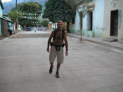
The finish line in Urique!

I was pretty well exhausted after being on the trail for ten hours. I had trained really hard for the race and was in pretty good shape.

The Tarahumaras ran it in five and one half hours. They all finished within thirty minutes of each other.

Here we are in front of the restaurant belonging to Jose Quintana. Jose also has a nice hotel (Estrella del Rio) where we spent the night.

Typical Tarahumara cave dwelling! Many of the fifty thousand Tarahumaras that live in the Copper Canyon live in dwellings similar to this. Most of them build cute log cabins and live dispersed throughout the huge canyon system.

The overlook at Divisadero! Probably the most well known tourist stop in Copper Canyon. The world-famous Copper Canyon train always stops here for "photo Ops" and to drop off tourists staying at the beautiful hotel sitting on the rim.

Sunday, January 20, 2008

Rip and Tide
Anti tobacco teaching program.

SINGLE SET:$19.95 - 1 CD, 3 books, 3 cards
ORDER NOW: http://www.megamel.com/

This exciting product has been widely acclaimed in the Los Angeles Unified school system. Kids love it!

Check it out further at: http://www.ripandtide.blogspot.com/

MegaMel and Sandie's Nova Scotia Trip


We have a few friends that had taken a trip to Nova Scotia and it seemed like it might be a fun place to visit. I read about a trip all the way around the Gaspe Peninsula (look it up) by motorcycle and that intrigued me as well. We left Colorado Springs in early summer with our MoHo, a 21' sea kayak, a DR650 motorcycle, and two mountain-bikes. The drive around Lake Superior was quite nice. This was our campsite in Montreal. Actually, camping in a construction parking lot worked really well. We were blocks from the "old town" and miles of nice bicycling trails. Don't plan on speaking English.


Quebec city is about as cool a place as we ever been. Very romantic! We parked the MoHo across the river (Free camping!) and rode the ferry over for site-seeing.


One of the thousand picturesque villages along the way. A great campsite until morning when some guys from the town came up and posted the "No Camping" sign in front of the MoHo. Oh well!


Sure, there are many, many lighthouses to check out. We did lots of day-trips on the DR650. Fun!


No one told me how dangerous it is on Prince Edward Island. Mosquitoes!

We rounded the Gaspe, headed south thru New Brunswick, crossed the biiiiigggg bridge to Prince Edward Island, and headed on down to Nova Scotia.


Yes! The Cabot Trail! We'd received post cards from friends showing this place. Some great hiking and a chance to try and outrun some big moose.


Going for a hike!


We left the MoHo in good hands in Nova Scotia and hopped a ferry to Newfoundland (emphasis on found) Land. It was little tight on the DR650 with Sandie and I along with all our luggage (see the duffel-bag) doing a six day trip.


At the top of Newfoundland we jumped on another ferry to see Labrador. This is Red Cove, the site of the first commercial operation in North America (a whaling business).


Famous Peggy's Cove. Everyone must go here while in Nova Scotia. A bit foggy/ wet.


Hangin' at Peggy's Cove!


Mt. Washington! We rode the motorcycle up in fog as thick as "whatsyacallit" and enjoyed seeing the steam train bring tourists up. We did a hike on the way back down and got caught in a nasty thunderstorm (lots of water).


Paddling the kayak at Laconia!


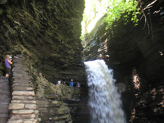
I always thought of Watkins Glen as a racetrack but we found out it's a cool place to hike.

The MoHo broke down in New York and we camped for a week in the parking lot of a Ford dealer waiting for repairs.

We had a nice week, hiking, biking, and site-seeing.


Saturday, January 12, 2008

Mt. Blodgett Snow Hike - 1/11/08

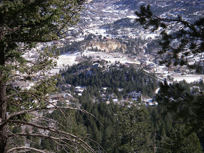
What better way to loosen up a bad ham-string injury than a fun mountain-climb. Two weeks ago I pulled it pretty bad (pain level 9). Two days ago an MRI and yesterday I had my first physical therapy. While I was in their office Mt. Blodgett was engulfed in blizzard/ white-out conditions. By the time I walked outside, it looked like this Pic. looking out my back door.


The parking area to start the hike is at 7,000 feet elevation and the top is at 9,500 feet. The hiking distance is 2.5 miles. Do the math! That's a 20 percent grade.

On the way up you pass by this drill site where testing was done to determine suitability for an underground space monitoring site (now known as NORAD in Cheyenne Mtn. on the south side of Colorado Springs).


I was pretty exicited to see that no-one had been up the trail since the latest snow. The "Fun-Factor" went up a bit and the adventure got better.


Rock formations next to Mt. St. Francis. A cool tuberculosis sanatoriam from the 1900's. They built small hexagon shaped cabins with no windows and people from all over the country came to live in the fresh air for their cure.


The trail goes thru this "hole-in-the-rocks".


One of the routes to the top is thru the trees and up the boulder field. Going up that way feels like climbing a 14'er (nickname for the 54 14,000 foot peaks that we have in Colorado).
Note! It took me 25 years to climb all those.


A pretty section of trail about a third of the way up.


Wow! I made it! In good conditons with a light pack, I make it to the top in 75 minutes.
Today it took me 2-1/2 hours.
That's the Air Force Academy cadet area. A great place to visit. You can just make out the Chapel that's the focal point.

The grounds include 18,000 acres open to the public like a national park. Lot's of hiking trails!


Water treatment plant including the Tesla Hydroelectric facility.
This is directly below the summit.


Rampart Reservior lies west of the summit.


Pikes Peak lies southwest of the summit.
The Pikes Peak Highway switch-backs up the face you see and the Barr Trl. (hiking) is on the face to the left.


It was cold and windy on top and I didn't hang out too long.


There's Cheyenne Mtn. where the NORAD facility sits far underground. The giant rooms sit on huge springs to make it "bomb-proof".